File:BruceBearMap.jpg
From WikiPOBia
Revision as of 02:41, 24 December 2013 by Alice Gomez (Talk | contribs)

No higher resolution available.
BruceBearMap.jpg (750 × 419 pixels, file size: 108 KB, MIME type: image/jpeg)
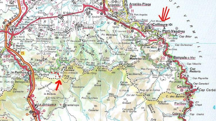
A more detailed map of the passage of Stephen and the Bear across the Pyrenees
File history
Click on a date/time to view the file as it appeared at that time.
(Latest | Earliest) View (newer 50) (older 50) (20 | 50 | 100 | 250 | 500)| Date/Time | Thumbnail | Dimensions | User | Comment | ||
|---|---|---|---|---|---|---|
| current | 02:41, 24 December 2013 |
| 750×419 (108 KB) | Alice Gomez (Talk | contribs) | (A more detailed map of the passage of Stephen and the Bear across the Pyrenees) |
- Edit this file using an external application (See the setup instructions for more information)
File links
There are no pages that link to this file.

